
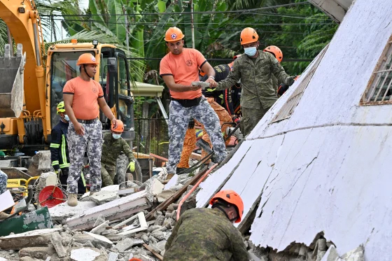
An offshore earthquake with a preliminary magnitude of 7.6 rocked Davao Oriental, a province in the southern Philippines, on Friday morning. The incident has triggered warnings of a potential hazardous tsunami in surrounding areas, raising alarm among local authorities and residents.
According to the Philippine Institute of Volcanology and Seismology (PHIVOLCS), the earthquake originated from a shallow fault movement at a depth of just 10 kilometres. The epicentre of the tremor was located approximately 62 kilometres southeast of Manay town. Following the significant seismic event, authorities issued alerts about possible damage and strong aftershocks, urging residents to stay vigilant.
The Pacific Tsunami Warning Center in Honolulu reported that hazardous waves might develop within 300 kilometres of the epicentre. Coastal areas of the Philippines could experience waves reaching up to 3 metres above normal tide levels. Additionally, smaller tsunami waves might affect nearby regions such as Indonesia and Palau.
Recently, the Philippines faced another earthquake, a magnitude 6.9 tremor that struck on September 30, claiming the lives of at least 74 individuals and displacing thousands in the central province of Cebu, particularly in Bogo city and its surrounding towns.
Known as one of the world’s most disaster-prone countries, the Philippines sits on the Pacific “Ring of Fire”, an area renowned for frequent seismic and volcanic activity. The nation also faces threats from approximately 20 typhoons and storms each year, making disaster preparedness crucial for both the government and local volunteer organizations.
In light of the earthquake, authorities have strongly encouraged coastal residents to remain alert and adhere to evacuation protocols until the tsunami threat fully subsides. The local government is coordinating efforts to monitor the situation while ensuring the safety of the populace.


